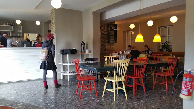
Restaurant nearby Ginger
Coronavirus disease (COVID-19) Situation
confirmed cases
209906
deaths
229
Iceland
Restaurant nearby Ginger
Ginger
Austurstræti, 101, Reykjavík, IS Ísland
contacts phone
:
+354 555 7570
website:
www.ginger.is
Latitude:
64.1475524
, Longitude:
-21.9375986
larger map & directions
read more
nearest Restaurant
42 m
Apotek
Austurstræti 16, Reykjavík
Restaurant
read more
68 m
The Icelandic Fish and Chips Wagon
Geirsgata, Reykjavík
Restaurant
read more
97 m
Jacobsen Loftið
Austurstræti 9, Austurstræti, Reykjavík
Restaurant
read more
111 m
Dirty Burger & Ribs
Austurstræti 18, Reykjavík
Restaurant
read more
120 m
Skólabrú Restaurant
Pósthússtræti 17, Reykjavík
Restaurant
read more
132 m
American Style
Tryggvagata 26, Reykjavík
Restaurant
read more
140 m
BÚLLAN BURGER JOINT
Bankastræti 5, Reykjavík
Restaurant
read more
161 m
Burro
1 2. hæð,, Veltusund 1, Reykjavík
Restaurant
read more
163 m
Essensia
Hverfisgata 4-6, Reykjavík
Restaurant
read more
172 m
Tommi's Burger Joint
Bankastræti 3, Reykjavík
Restaurant
read more
178 m
Bergsson Mathús
Templarasund 3, Reykjavík
Restaurant
read more
235 m
Hverfisgata 12
Hverfisgata 12, Reykjavík
Restaurant
read more
241 m
Geysir Bistro
Aðalstræti, Reykjavík
Restaurant
read more
312 m
Ostabúðin
Skólavörðustígur 8, Reykjavík
Restaurant
read more
365 m
Kolabrautin Ristorante
2,, Austurbakki, Reykjavík
Restaurant
read more
383 m
Ramen Momo
Tryggvagata 16, Reykjavík
Restaurant
read more
523 m
Sumac Grill + Drinks
Laugavegur 28, Reykjavík
Restaurant
read more
538 m
Forettabarinn
Nýlendugata 14, Reykjavík
Restaurant
read more
660 m
Meze
42,, Laugavegur 32, Reykjavík
Restaurant
read more
720 m
ROK
Frakkastígur 26a, Reykjavík
Restaurant
read more
835 m
Reykjavik Chips
Vitastígur, Reykjavík
Restaurant
read more
874 m
Flatey
Grandagarður 11, Reykjavík
Restaurant
read more
929 m
Old Iceland
Laugavegur 72, Reykjavík
Restaurant
read more
972 m
Subway
Hringbraut 12, Reykjavík
Restaurant
read more
1.031 km
Subway
Laugavegur 86, Reykjavík
Restaurant
read more
📑
all categories
Accounting
Administrative area level 1
Administrative area level 2
Airport
Amusement park
Aquarium
Art gallery
Atm
Bakery
Bank
Bar
Beauty salon
Bicycle store
Book store
Bowling alley
Bus station
Cafe
Campground
Car dealer
Car rental
Car repair
Car wash
Casino
Cemetery
Church
City hall
Clothing store
Convenience store
Country
Courthouse
Dentist
Department store
Doctor
Electrician
Electronics store
Embassy
Establishment
Finance
Fire station
Florist
Food
Funeral home
Furniture store
Gas station
General contractor
Grocery or supermarket
Gym
Hair care
Hardware store
Health
Hindu Temple
Home goods store
Hospital
Insurance agency
Jewelry store
Laundry
Lawyer
Library
Liquor store
Local government office
Locality
Locksmith
Lodging
Meal delivery
Meal takeaway
Mosque
Movie theater
Moving company
Museum
Natural feature
Neighborhood
Night club
Painter
Park
Parking
Pet store
Pharmacy
Physiotherapist
Place of worship
Plumber
Point of interest
Police
Post office
Premise
Real estate agency
Restaurant
Route
Rv park, camping
School
Shoe store
Shopping mall
Spa
Stadium
Storage
Store
Subpremise
Supermarket
Synagogue
Taxi stand
Transit station
Travel agency
University
Veterinary care
Zoo
sublocality level 1
↑