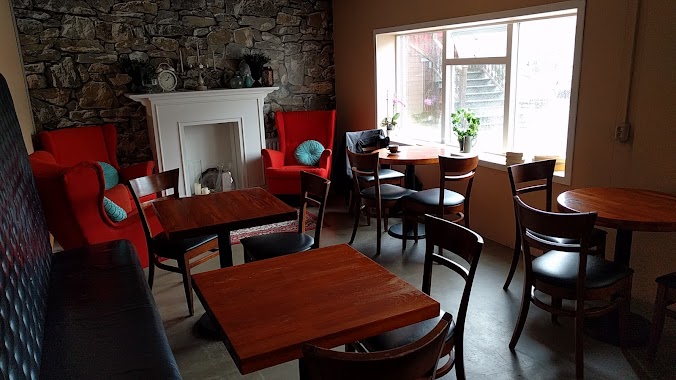
Cafe nearby The Icelandic Soup Wagon
Iceland
Cafe nearby The Icelandic Soup Wagon
The Icelandic Soup Wagon
Islandia
contacts phone
:
+354
Latitude:
63.8955448
, Longitude:
-22.0504712
larger map & directions
read more
nearest Cafe
14.369 km
Southern Peninsula, Iceland
Iceland
Cafe
read more
18.617 km
Northern Light Inn & Max's Restaurant
Norðurljósavegur 1, Grindavík
Cafe
read more
19.102 km
T-bær Selvogi
Iceland
Cafe
read more
19.174 km
Pallett Kaffikompaní
Strandgata 75, Hafnarfjörður
Cafe
read more
19.174 km
Pallett
Strandgata 75, Hafnarfjörður
Cafe
read more
19.77 km
Café Deluxe
Strandgata 29, Hafnarfjörður
Cafe
read more
19.889 km
Súfistinn
Strandgata 9, Hafnarfjörður
Cafe
read more
22.578 km
Olís
Hafnarfjarðarvegur, Garðabær
Gas station
Convenience store
Cafe
Car wash
Store
Restaurant
Point of interest
Food
Establishment
read more
22.998 km
Kökubankinn
Gardabaer
Cafe
read more
23.015 km
Álftanes Kaffi
Breiðamýri, Álftanes
Cafe
read more
24.192 km
Krispy Kreme
Hagasmári 1, Kópavogur
Cafe
read more
24.283 km
Te & Kaffi
Hagasmári 1, Kópavogur
Cafe
read more
24.359 km
Dunkin' Donuts
Hagasmára 9, Kópavogi
Cafe
read more
25.066 km
Te & Kaffi
Hamraborg 10, Kópavogur
Cafe
read more
25.086 km
Olís Hamraborg
Hamraborg 12, Kópavogur
Car wash
Cafe
Gas station
Store
Point of interest
Food
Establishment
read more
25.283 km
Málum og Skálum
Auðbrekku 6, Kópavogi
Cafe
read more
25.387 km
Fellakaffi
Reykjavík
Cafe
read more
25.481 km
Kruðerí
18, Nýbýlavegur, Kópavogur
Cafe
read more
25.481 km
Kruðerí
Nýbýlavegur 18, Kópavogur
Cafe
Point of interest
Food
Establishment
read more
25.5 km
yoyo ferskur jógúrtís
Nýbýlavegur 18, Kópavogur
Cafe
read more
25.519 km
Dunkin' Donuts
Fitjar, Reykjanesbær
Cafe
read more
25.662 km
Handverk I Havegum Haft Bakery
Njardvik
Cafe
read more
26.759 km
Keflavik Kwatera
Bakkastígur, Reykjanesbær
Cafe
read more
26.952 km
Cafe petite
23,, Framnesvegur, Reykjanesbær
Cafe
read more
27.405 km
Café Keflavik
Hafnargata 28, Keflavík
Cafe
read more
📑
all categories
Accounting
Administrative area level 1
Administrative area level 2
Airport
Amusement park
Aquarium
Art gallery
Atm
Bakery
Bank
Bar
Beauty salon
Bicycle store
Book store
Bowling alley
Bus station
Cafe
Campground
Car dealer
Car rental
Car repair
Car wash
Casino
Cemetery
Church
City hall
Clothing store
Convenience store
Country
Courthouse
Dentist
Department store
Doctor
Electrician
Electronics store
Embassy
Establishment
Finance
Fire station
Florist
Food
Funeral home
Furniture store
Gas station
General contractor
Grocery or supermarket
Gym
Hair care
Hardware store
Health
Hindu Temple
Home goods store
Hospital
Insurance agency
Jewelry store
Laundry
Lawyer
Library
Liquor store
Local government office
Locality
Locksmith
Lodging
Meal delivery
Meal takeaway
Mosque
Movie theater
Moving company
Museum
Natural feature
Neighborhood
Night club
Painter
Park
Parking
Pet store
Pharmacy
Physiotherapist
Place of worship
Plumber
Point of interest
Police
Post office
Premise
Real estate agency
Restaurant
Route
Rv park, camping
School
Shoe store
Shopping mall
Spa
Stadium
Storage
Store
Subpremise
Supermarket
Synagogue
Taxi stand
Transit station
Travel agency
University
Veterinary care
Zoo
sublocality level 1
↑