School nearby Stapi
Iceland
School nearby Stapi
Stapi
101 Reykjavík, Iceland
contacts phone
:
+354
website:
www.hi.is
Latitude:
64.1415982
, Longitude:
-21.9471337
larger map & directions
read more
nearest School
368 m
Árnagarður
Árnagarður, Sturlugata 1, Reykjavík
School
read more
471 m
Kvennaskólinn
Fríkirkjuvegur 9, Reykjavík
School
read more
473 m
Kvennaskólinn í Reykjavík
Miðborg
School
read more
509 m
VR -II
2, Hjarðarhagi 6, Reykjavík
School
read more
512 m
Hagaskóli
Fornhagi 1, Reykjavík
School
read more
518 m
Kvennaskólinn, U building
Reykjavík
School
read more
525 m
Melaskóli
Reykjavík
School
read more
546 m
Kvennaskólinn, M building
Fríkirkjuvegi 9, Reykjavík
School
read more
577 m
Hagaskóli íþróttamiðstöð
Neshagi 6, Reykjavík
School
read more
674 m
Fire Yoga Studio
Hofsvallagata 16, Reykjavík
School
read more
683 m
Leikgarður
14,, Eggertsgata, Reykjavík
School
read more
683 m
Mánagarður
34,, Eggertsgata, Reykjavík
School
read more
701 m
Landakotsskóli
Reykjavík
School
read more
703 m
Menntaskólinn í Reykjavík
Þingholtsstræti 12, Reykjavík
School
read more
722 m
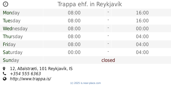
Trappa ehf.
Aðalstræti 12, Reykjavík
School
read more
780 m
Iceland Academy of the Arts, dance studio
Austurstræti 22a, Reykjavík
School
read more
798 m
Öldukot
Öldugata 19, Reykjavík
School
read more
813 m
Vesturborg
Hagamelur 55, Reykjavík
School
read more
830 m
Mímir Símenntun (Gamli Stýrimannaskólinn)
Öldugata 23, Reykjavík
School
read more
904 m
Sæborg
11,, Starhagi, Reykjavík
School
read more
917 m
Grænaborg
Eiríksgata 2, Reykjavík
School
read more
967 m
AOPA Iceland
21, Þorragata, Reykjavík
School
read more
1.015 km
Drafnarborg
Ránargata 51, Reykjavík
School
read more
1.042 km
West End Elementary School
Sólvallagata 67, Reykjavík
School
read more
1.282 km
Grandaborg
Bođagrandi 107, Boðagrandi, Reykjavík
School
read more
📑
all categories
Accounting
Administrative area level 1
Administrative area level 2
Airport
Amusement park
Aquarium
Art gallery
Atm
Bakery
Bank
Bar
Beauty salon
Bicycle store
Book store
Bowling alley
Bus station
Cafe
Campground
Car dealer
Car rental
Car repair
Car wash
Casino
Cemetery
Church
City hall
Clothing store
Convenience store
Country
Courthouse
Dentist
Department store
Doctor
Electrician
Electronics store
Embassy
Establishment
Finance
Fire station
Florist
Food
Funeral home
Furniture store
Gas station
General contractor
Grocery or supermarket
Gym
Hair care
Hardware store
Health
Hindu Temple
Home goods store
Hospital
Insurance agency
Jewelry store
Laundry
Lawyer
Library
Liquor store
Local government office
Locality
Locksmith
Lodging
Meal delivery
Meal takeaway
Mosque
Movie theater
Moving company
Museum
Natural feature
Neighborhood
Night club
Painter
Park
Parking
Pet store
Pharmacy
Physiotherapist
Place of worship
Plumber
Point of interest
Police
Post office
Premise
Real estate agency
Restaurant
Route
Rv park, camping
School
Shoe store
Shopping mall
Spa
Stadium
Storage
Store
Subpremise
Supermarket
Synagogue
Taxi stand
Transit station
Travel agency
University
Veterinary care
Zoo
sublocality level 1
↑