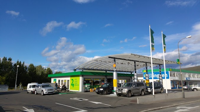
Gas station nearby Atlantsolía- Glerártorg
Iceland
Gas station nearby Atlantsolía- Glerártorg
Atlantsolía- Glerártorg
Glerárgata, 600, Akureyri, IS Islandia
contacts phone
:
+354 591 3100
Latitude:
65.6878039
, Longitude:
-18.0995642
larger map & directions
read more
nearest Gas station
165 m
Olís Akureyri
Tryggvabraut 1, Akureyri
Gas station
read more
242 m
N1
600, Tryggvabraut, Akureyri
Gas station
read more
526 m
N1
Þjóðvegur, Akureyri
Gas station
read more
530 m
N1
Hörgárbraut, Akureyri
Gas station
read more
583 m
Orkan
Furuvellir, Akureyri
Gas station
read more
584 m
Orkan
Furuvöllum, 17, Akureyri
Gas station
read more
586 m
Orkan
17, Furuvöllum, Akureyri
Gas station
read more
664 m
ÓB BSO
Strandgötu, Akureyri
Gas station
read more
664 m
ÓB BSO
Strandgata, Akureyri
Gas station
read more
992 m
Orkan
Mýrarvegur, Akureyri
Gas station
read more
992 m
Orkan
Mýrarvegi, Akureyri
Gas station
read more
1.332 km
ÓB Akureyri
Hlíðarbraut, Akureyri
Gas station
read more
1.355 km
Shell
Þjóðvegur, Akureyri
Gas station
read more
1.363 km
Skeljungur
Hörgárbraut, Akureyri
Gas station
read more
2.052 km
ATLANTSOLÍA - NORÐUR AKUREYRI
Baldursnes, Akureyri
Gas station
read more
2.054 km
Atlantsolía
Baldursnes 3, Baldursnes, Akureyri
Gas station
read more
2.08 km
Orkan X
Kjarnagata 2, Akureyri
Gas station
read more
2.116 km
Orkan X
Kjarnagötu 2, Akureyri
Gas station
read more
2.176 km
N1
Leiruvegur, Akureyri
Gas station
read more
29.04 km
N1 Grenivík
610, Túngata 3, Grenivík
Gas station
read more
30.79 km
Orkan
Hafnarbraut
Gas station
read more
36.713 km
Olís Dalvík
Skíðabraut 21, Dalvík
Gas station
read more
50.584 km
Orkan
Skútustöðum, 2c, Mývatn
Gas station
read more
52.03 km
Olís Húsavík
Garðarsbraut 64, Húsavík
Gas station
read more
52.03 km
Olís
Garðarsbraut 64, Húsavík
Gas station
read more
📑
all categories
Accounting
Administrative area level 1
Administrative area level 2
Airport
Amusement park
Aquarium
Art gallery
Atm
Bakery
Bank
Bar
Beauty salon
Bicycle store
Book store
Bowling alley
Bus station
Cafe
Campground
Car dealer
Car rental
Car repair
Car wash
Casino
Cemetery
Church
City hall
Clothing store
Convenience store
Country
Courthouse
Dentist
Department store
Doctor
Electrician
Electronics store
Embassy
Establishment
Finance
Fire station
Florist
Food
Funeral home
Furniture store
Gas station
General contractor
Grocery or supermarket
Gym
Hair care
Hardware store
Health
Hindu Temple
Home goods store
Hospital
Insurance agency
Jewelry store
Laundry
Lawyer
Library
Liquor store
Local government office
Locality
Locksmith
Lodging
Meal delivery
Meal takeaway
Mosque
Movie theater
Moving company
Museum
Natural feature
Neighborhood
Night club
Painter
Park
Parking
Pet store
Pharmacy
Physiotherapist
Place of worship
Plumber
Point of interest
Police
Post office
Premise
Real estate agency
Restaurant
Route
Rv park, camping
School
Shoe store
Shopping mall
Spa
Stadium
Storage
Store
Subpremise
Supermarket
Synagogue
Taxi stand
Transit station
Travel agency
University
Veterinary care
Zoo
sublocality level 1
↑